Stratigraphic and Structural Analysis of the Jaintia-Jaflong Monocline: Insights from Field Investigations
Abstract:
The Jaintiapur-Jaflong region, strategically positioned between the subsiding Surma Basin to the south and the uplifting Shillong Massif to the north, presents a unique geological setting. This study employed geological clinometers and other field methods to ascertain the geological characteristics of the area. The regional strike was determined to be N66˚W, with a dip direction of S24˚W and a dip angle of 42.25˚. Through extensive field investigations, including geological mapping, stratigraphic logging, rock sampling, fossil analysis, and structural analysis, complemented by Global Positioning System (GPS), photography, remote sensing, and Geographic Information System (GIS) technologies, seven lithostratigraphic units were identified. These include the variegated color sandstone, mottled clay, yellowish to reddish-grey sandstone, sandy shale with intercalated silty shale, pinkish sandstone, bluish to blackish-grey shale, and limestone units, corresponding sequentially to Dupi Tila, Girujan Clay, Tipam Sandstone, Surma Group, Jenum Shale Fm, Kopili Shale, and Sylhet Limestone Fm, respectively. Five critical geological contact boundaries were delineated, with notable boundaries identified at the Dupigaon-Sari River Section, the Lalakhal-Tetulghat Section, the Nayagang-Gourishankar Section, and between the Barail and Jaintia groups at the Tamabil-Jaflong Highway Road Cut Section. These findings elucidate the geological contacts and stratigraphic units, providing significant implications for paleoenvironmental reconstruction, resource potential assessment, and stratigraphic correlation, thus enhancing the understanding of regional geological history and laying a foundation for future research endeavors.
1. Introduction
The Jaintiapur-Jaflong region (Figure 1) lies in the northern part of the uplifting Shillong Massif and the southern part of the subsiding Surma Basin [1], with the Dauki Fault forming a significant tectonic boundary between them. Located in the north-eastern part of Bangladesh, the Surma basin is a sub-basin of the greater Bengal Basin and also one of the largest and most prominent deltaic basins in the world. The basin is confined to the southeast by the Chittagong-Tripura fold belt of the Indo-Burman ranges [2]. The Surma Basin and the Shillong Massif are of substantial global geological significance due to their unique geological settings, rich fossil records, and complex tectonic history. The combined study of the Surma Basin and the Shillong Massif is particularly valuable for understanding the interactions between sedimentary basins and adjacent highlands. The geological processes that have shaped these regions, including erosion, sediment transport, and deposition, as well as tectonic uplift and subsidence, are critical for constructing comprehensive models of continental dynamics. The Surma Basin offers a detailed record of sedimentation processes over millions of years. Its stratigraphy includes deep marine, deltaic, and fluvial deposits, making it an ideal site for studying sedimentary processes and basin evolution in response to tectonic activity and sea-level changes. Additionally, the Surma Basin is crucial for its hydrocarbon resources. The thick (2500m-3500m) sedimentary sequences deposited in the basin contain substantial reserves, particularly natural gas. Studies of the basin contribute to understanding the formation, migration, and accumulation of hydrocarbons, which is critical for energy resources [3]. The sedimentary records in the Surma Basin contain valuable information on paleoclimatology and oceanographic conditions, offering insights into how these have changed over geological timescales.
The Shillong Massif forms part of the Meghalaya Plateau and is characterized by Precambrian rocks, including granites, gneisses, and schists, with some younger sedimentary cover. It has numerous global implications for tectonic and structural studies, seismicity and earthquake studies, Precambrian geology, and landscape evolution. The Shillong Massif exhibits complex structural features, including numerous faults and folds, which are critical for understanding the tectonic processes that shape the continental crust. The elevated terrain of the Shillong Massif influences regional climate patterns and erosion processes, impacting sediment supply to adjacent basins like the Surma Basin [4]. The investigated area lies between latitude 25⁰05’42”N to 25⁰10’54’’N and longitude 92⁰07’4’’E to 92⁰01’06’’E, indicating the range from the initial station to the extreme position. About 18% of hilly regions are dominant in Bangladesh which covers most probably northeast to eastern parts [5]. The investigated area is located about 30km northeast of Sylhet town and it is in the northeastern part of Sylhet district, Bangladesh. The study area is characterized by a rugged landscape and has the highest number of formations of Tertiary and Quaternary deposits in the Bengal Basin, creating east-west-trending small valleys.
Understanding the geological and tectonic settings of the Jaintiapur-Jaflong region has significant implications for local communities. The geological formations in the Jaintiapur-Jaflong region influence soil composition and fertility, which directly impact agricultural practices. Areas with fertile soils derived from weathered sedimentary rocks support diverse crops, benefiting local agriculture and livelihoods. Studies of lithostratigraphic units can help identify areas with optimal soil conditions for different types of crops, promoting sustainable agricultural practices and improving crop yields [6]. The region's tectonic activity, particularly along fault lines, affects land stability. Understanding these dynamics can inform land use planning to avoid areas prone to landslides and erosion. Geological studies can identify stable areas for building infrastructure, such as roads, schools, and housing, reducing the risk of damage from geological hazards [7].
Extensive geological research has been conducted in the Jaintiapur upazila and its adjacent areas, as documented by various authors [8], [9], [10], [11]. Over the years, several geological studies have been conducted to understand the area's stratigraphy, tectonics, and mineralogy. Early studies focused on the stratigraphy of the region, identifying various sedimentary rock formations ranging from the Eocene to the recent period. Researchers have documented a sequence of sedimentary layers, including sandstones, shales, and limestones. Research has shown that the area has experienced multiple phases of tectonic activity, leading to faulting, folding, and uplift, which have shaped the current topography and geological structures. Studies have also reported occurrences of coal, limestone, and clay, contributing to the economic significance of the region. Key findings from previous studies on this region include geological mapping, fault dynamics, and resource evaluation. This study aims to build upon previous geological research by incorporating modern techniques and technologies such as integrated geological modelling, rock sampling, fossil and structural analysis, stratigraphic correlation and hazard assessments. Initial geological surveys in the Jaintiapur-Jaflong region were primarily conducted by British colonial geologists in the late 19th and early 20th centuries. These surveys laid the groundwork for understanding regional geology but were limited in scope and detail [12]. More detailed studies emerged in the mid-20th century, with researchers focusing on the stratigraphy and structural geology of the region. Notable work by Hiller and Elahi [3] provided insights into the structural development and hydrocarbon potential of the Surma Basin, highlighting the importance of tectonic activity in shaping the region's geology. Comprehensive geological and geophysical studies in the late 20th and early 21st centuries have further refined the understanding of the region's geology. For instance, Johnson and Alam [4] examined sedimentation and tectonics in the Sylhet Trough, emphasizing the interplay between tectonic uplift and sedimentation. Recent studies have utilized advanced techniques such as seismic reflection profiling, satellite imagery, and geochemical analyses to delve deeper into tectonic and sedimentary processes. Steckler et al. [7] focused on the seismic hazards associated with the Dauki Fault, providing crucial data for risk assessment and infrastructure planning. Hossain et al. [13] explored the tectonic and sedimentary evolution of the Sylhet Trough, shedding light on the region's hydrocarbon potential and tectonic history. But there is currently a lack of detailed orientation and sedimentological information on geological contact boundaries among several geological units in the studied areas. The accurate depiction of geological contacts involves geologic mapping which is an essential tool to separate two distinct geologic lithostratigraphic units [14].
Numerous laterite beds were found at the edge of the geologic contact zones in this study. Laterite beds in the region show significant deformation, including tilting and faulting, directly attributed to the tectonic movements along the Dauki Fault [15, 16]. Geological contact boundaries serve as key markers for understanding the stratigraphic correlation with regional geologic formations and play a vital role in assessing tectonic activity and seismic hazards, preserving fossil records, and reconstructing the Earth's history. The study aims to: (i) investigate the specific location and orientation of geological contact boundaries through a petrographic sedimentary structural analysis; (ii) explore the attitude of sedimentary bedding planes; and (iii) compare lithostratigraphy with the regional Sitapahar Anticline Formation. The Chittagong Tripura Fold Belt (CTFB) is located near the Sitapahar Anticline with a length of about 70km in the north-south direction and a width of 12km in the east-west direction of Bangladesh [17]. The findings of this study contribute to future academic and exploration activities in the anticipated area.

2. Geological and Tectonic Setting of the Investigated Area
Geologically, Bangladesh is located at the triple junction of three interacting plates in a critical position, namely, the Indian, Burmese, and Eurasian plates at the northeastern edge of the Bay of Bengal [18]. The convergence rate between the Eurasian and Indian plates is about 50 mm/year [19]. However, recent estimates suggest a reduced rate of convergence, now quantified at 10-25 mm/year [20]. The Indian Plate is moving northwards at a rate of approximately 5 cm per year relative to the Eurasian Plate [21]. This movement results from the ongoing collision between the Indian and Eurasian plates, which has been occurring since the late Cretaceous period [22]. The Bengal Basin is divided into three distinct geotectonic provinces, such as the Stable Shelf to the northwest, the Foredeep Basin to the center and the Folded Flank to the east [23] which are separated by paleocontinental slopes of the Eocene hinge zone. The Bengal Basin is confined to the west and north by the Precambrian Indian Shield and by the Indo-Burman orogen to the east; it extends a significant distance into the Bay of Bengal [24]. Figure 2 shows that, according to the recent geodetic measurement, the motion of the Indian Plate is approximately 6 cm/year in the northeast direction and it is subducting under the Eurasian Plate at a rate of approximately 45 mm/year, and under the Burmese Plate at a rate of about 46 mm/yr in the north and east, respectively [25]. The collision between the Indian and Eurasian plates generates significant tectonic stress, leading to crustal deformation, uplift, and Dauki faulting. This fault is seismically active, with frequent earthquakes resulting from the accumulated tectonic stress. The northward movement of the Indian Plate impacts sedimentation patterns in the Jaintiapur-Jaflong region. The differential movement and resulting subsidence in the Surma Basin create accommodation space for thick sedimentary deposits, including the Surma Group and Tipam Sandstone formations.
The paleocontinental slopes within the Eocene hinge zone play a critical role in shaping the geological structure of the Jaintia-Jaflong region in Sylhet. The Eocene hinge zone, located at the transition between the Indian Shield and the Bengal Basin, is characterized by significant tectonic activity during the Eocene epoch. It is characterized by significant changes in sedimentation patterns and structural features due to variations in tectonic activity and sea-level changes [26]. The variations in slope gradients affected the types and distribution of sediments. Coarser sediments were deposited at the base of the slopes, while finer sediments were carried further into the basin [27]. These slopes significantly influenced sedimentation patterns in the Jaintia-Jaflong region and also acted as conduits for sediment gravity flows, such as turbidity currents, which deposited large volumes of sediment into the basin [28]. The Jaintia group often found at the base of the slope, consists of shallow marine carbonates deposited during periods of relative tectonic quiescence. The Jaintia group, often found at the base of the slope, consists of shallow marine carbonates deposited during periods of relative tectonic quiescence [29]. The Surma group, including sandy shale and silty shale units, was significantly influenced by sediment inputs from the paleo-continental slopes, contributing to its heterogeneity. The presence of paleo-continental slopes within the hinge zone also led to the development of significant structural features. Faulting and folding associated with the Eocene tectonics resulted in the deformation of these slopes, influencing the structural architecture of the region [30]. The sedimentary deposits associated with paleo-continental slopes are often rich in organic material, making them significant for hydrocarbon exploration. Understanding these slopes helps identify potential reservoir rocks and source beds.
The Jaintapur and adjoining areas of northeastern Bangladesh are formed as a tectonically complex province of the Bengal Basin. Alam et al. [30] offered a detailed geological evolution of the Bengal Basin, incorporating data from the Surma Basin and surrounding areas to understand the broader tectonic framework. Geographically, the investigated area is part of the Surma Basin in the Bengal foredeep of the Bangle Basin. The Surma Basin, situated in northeastern Bangladesh, developed in response to the interaction between the prograding mobile Indo-Burman Fold Belt to the east and the rising Shillong Plateau to the north. A seismic investigation was carried out in Jaflong, Sylhet, Bangladesh, which is in the eastern part of the Dauki Fault [31]. The area is bounded by the prominent east-west-oriented Dauki Fault to the north, which is still active [32]. The studied area is marked by various lithostratigraphic units and prominent structural features influenced by major tectonic forces, including the activity of the Dauki Fault and the presence of paleo-continental slopes within the Eocene hinge zone. Through detailed field surveys, structural analysis, and sedimentological studies, this study aims to delineate the geological contact boundaries, characterize the lithostratigraphic units, and assess the influence of tectonic activities on the region's geological framework.
3. Materials and Methods
The research methodology of this study is based on a combination of both primary and secondary data. The primary data collection technique predominantly involves a five-day geological field survey in Jaintiapur, Dupigaon, Sari River, Lalakhal, Tamabil, Jaflong and Dauki River sections (Figure 3). All positioning coordinates were collected during the field survey and plotted in Google Earth software from the initial point to the extreme position (Figure 4).
The traversing method was used to measure bearing, trend, azimuth and distance during the field investigation along the sections where the rocks are well exposed. The clinometer was used to calculate the directions of the dip and strike and the amount of dip. Figure 5 shows the equipment used in the field. The information was plotted on the base map of the studied area to get a clear view of the outcrops. All the information was written down in a field notebook and photographs were taken by camera in every suitable geologic exposure.
About 37 stations were identified to determine suitable exposures at these geological investigation sites. The secondary data for the surface geological map was collected from the World Geologic Maps and the earth explorer website of the United States Geological Survey (USGS). The primary and secondary datasets were processed and analyzed using Microsoft Excel, Google Earth, and ArcGIS software.
4. Result
The studied area is situated to the south of the Shillong massif and encompasses Jaintiapur and surrounding areas, specifically the northeastern part of Sylhet district. The investigated area stretches from the Dauki River in the north and the Sari River to Lalakhal in the south. Four sections, such as Dupigaon-Sari River, Lalakhal Teagarden-Afifanagar, Rangapani River-Nayaganag and Dauki-Jaflong-Tamabil Road Cut sections, have been named to visualize the geological contact boundaries, as shown in Figure 6. These contact boundaries often show abrupt changes in bedding attitudes, reflecting shifts in depositional environments and tectonic settings. The Tamabil-Jaflong Highway Road Cut Section (Table 1 and Figure 7) marks a significant tectonic boundary. Figure 7 shows this distinctive feature boundary between Kopili shale and Barail sandstone near the Tamabil-Dauki Ground Port. This could indicate a major phase of tectonism, sedimentation, and possibly metamorphism. Understanding this contact is vital for regional tectonics and basin evolution studies. Moreover, many significant structural features were identified in this section, including a laterite bed between the Jaintia and Barail Group alongside the Tamabil-Jaflong Highway, fossiliferous Sylhet Limestone at Jaflong point, Horst and Graben Fault at Sripur Highway near the Tamabil-Dauki Ground Port, inclined joint in the Sylhet Limestone unit of the Dauki-Jaflong section, highly jointed Kopili shale, and thinly paper-laminated shale near Sripur Bazar. The Nayagang-Gourishankar Section (Table 2 and Figure 8) highlights the stratigraphic succession and potential unconformities, which are critical for reconstructing the geological history and potential hydrocarbon exploration. Figure 8 shows an angular local unconformity and lenticular bedding marked at the Rangapani River section, and laterite bed, convolute bedding, and minor drag fold at the Nayagang River section. The Lalakhal-Tetulghat Section (Table 3 and Figure 9) helps understand lateral facies changes and the depositional history of the area. It also helps with the correlation of stratigraphic units across different regions. Figure 9 shows a petrified wood inclusion identified in the Tipam Sandstone unit, as well as surficial deposit mud cracks, a peat seam, and ripple marks at the Lalakhal-Tetulghat Section. The Dupigaon-Sari River Section (Table 4 and Figure 10) provides a crucial insight into the transition between different depositional environments and periods of tectonic activity or sea-level changes. Laterite beds, mottled Girujan clay with fractures, clay galls, micro-parallel lamination, micro-cross lamination, and iron encrustation were identified at the Dupigaon-Sari River section, as shown in Figure 10.
Table 1, Table 2, Table 3 and Table 4 show the rock type, lithology, location of geologic contact, and sedimentary structure at the Dauki River-Jaflong-Tamabil Road Cut, Komla Bari-Rangapani-Nayagang-Gourishankar, Lalakhal-Tetulghat-Afifanagar and Dupigaon-Sari River sections.
Rock Type | Lithology | Sedimentary Structure | Symbol | |
Limestone | Whitish gray in color, permeable, crystalline, fossiliferous, cementing material calcareous, occasional gravel bed present. | Pot hole, micro and inclined joint. |  | |
Shale | Bluish to black in color, fissile in nature, cementing material carbonaceous, conchoidal fracture, fossiliferous. | Block and oblique Joint, thinly paper-laminated shale. |  | |
A distinct geologic contact is visible between Barail (Sst. unit) and Jaintia Group (Kopili sh. Unit) alongside the Tamabil-Jaflong Highway; a laterite bed found; GPS: 25⁰10’40’’N & 92⁰1’42’’E. |  | |||
Pinkish sandstone | Pink in color, fine to medium grain, cementing material ferruginous, and highly permeable. | Microcross lamination. |  | |
Sand shale alteration | Pinkish gray in color. | Local unconformity, conglomerate bed found. | 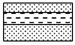 | |
Thick bedded sandstone | Yellowish brown in color, hard & compact, fine-grained, cementing material calcareous. | Bedding. |  | |
Pinkish sandstone | Pink in color, cementing material carbonaceous, some occasional peat layer present. | Iron encrustation. |  | |
Pinkish sandstone | pink in color, fine to medium grain, cementing material ferruginous. | Lamination. |  | |
Rock Type | Lithology | Sedimentary Structure | Symbol |
Pinkish sandstone | Pink in color, fine to medium grain, cementing material ferruginous, highly permeable. | Microcross lamination traced; inclined to a near vertical joint. |  |
Massive sandstone, silty shale to shale; laterite bed identified | Yellowish brown color, carbonaceous. | Microcross lamination; flame structure, convolute bedding and Liesegang Ring. |  |
Silty shale and siltstone alteration; thinly laminated shale | Silty shale is brownish gray in color, some iron encrustation with an occasional mud layer. | Lamination in silty shale and lenticular bedding in siltstone; cross-to-microcross lamination. |  |
A geologic contact was identified between Barail and Surma Group based on a 4m laterite bed at the Nayagang river section; GPS: 25⁰8’24’’N; 92⁰7’17’’E. |  | ||
Silty with laminated shale | Brownish gray in color, cementing material argillaceous. | Microcross lamination. |  |
Silty shale | Brownish gray in color, conchoidal fracture with mudstone streak. | Microcross lamination. |  |
Silty shale | Brownish gray in color, conchoidal fracture with mudstone streak, cementing material argillaceous. | Lenticular bedding; wavy bedding; heterolith sequence; cross lamination. |  |
Sandstone silty shale alteration | Grayish brown in color, thinly laminated, moderately compact, medium to fine grain. | Parallel lamination; lenticular bedding; heterolytic bedding. |  |
Fissile shale with minor silty composition | Streak brownish gray in color, conchoidal fracture with mudstone; slumping gravel bed. | Iron concretion; microcross lamination. |  |
Silt, sand and gravel composition | Grayish brown in color. | Hydrological feature-dug well. |  |
Sandstone, quartzite, granite, granodiorite | Poor to moderately sorted, weathered to sub-weathered gravel. | Moraine formation-ice age; angular local unconformity. |  |
Rock Type | Lithology | Sedimentary Structure | Symbol |
Silty shale & mudstone alteration | Silty shale is light gray in color, thinly laminated, moderately compact, sand lens present. Mudstone is a dark gray color, fissile in nature. | Microcross lamination & Nodules. |  |
Silty shale | Light gray color, moderately permeable, calcareous band present. | Microcross lamination. |  |
Sand shale alteration | Fine to medium grain, contains mica schist. | Planner cross bedding. |  |
Sandy laminated shale | Bluish gray and light yellow in weathered condition, highly compact, very poorly porous shale, cementing material argillaceous. | Planner trough cross bedding. micro cross lamination. |  |
Sandstone & shale -mudstone | Sandstone is reddish brown color, fine to medium grain, loosely compact. Shale is light gray color, fissile in nature, petrified wood. | Planner cross bedding & Lamination; current ripple; coal seam (peat); mud crack; stream. |  |
A geological contact boundary was traced between the Surma Group and Tipam Sandstone Fm. at the Lalakhal-Tetulghat Section based on lithofacies change, rock types, and lithology; GPS: 25⁰6’8’’N; 92⁰10’34’’E. |  | ||
Moderate to loose sandstone | Reddish brown color, fine to medium grain, loosely compacted. | Iron encrustation, microcross lamination. |  |
Moderately compacted sandstone | Yellowish brown color, medium to fine grain, ferruginous cementing material with conglomerate bed. | Iron encrustation, lamination. |  |
Fine to medium grain compacted sandstone | Yellow to brownish color with ferruginous cementing materials. | Fe encrustation, Inclined joint, desiccation mud cracks, surface weathering, surficial deposits. |  |
Ferruginous sandstone, organic matter inclusion | Whitish to brown-yellowish, fine to medium grain. | Petrified wood; laterite bed with Fe/Al leaching. |  |
Rock Type | Lithology | Sedimentary Structure | Symbol |
A geologic contact boundary was marked based on laterite bed between Tipam Sandstone Fm. and Girujun Clay Fm. GPS Reading of this location: 25⁰6’17’’N; 92⁰8’52’’E |
 | ||
Mottled clay | Bluish gray color, poorly permeable, soapy feel, cementing material carbonaceous. | Fe encrustation, near vertical joint, mud crack, fracture. | 
|
Clay dominance | Very fine to fine grain, grey to whitish color. | Iron concretion, oblique microjoint. |
 |
A geological contact boundary was traced between Girujan Clay and Dupitila Sandstone Fm based on the laterite bed, distinct facies, rock types and lithological changes; GPS: 25⁰5’54’’N; 92⁰8’40’’E |
 | ||
Variegated to yellowish color sandstone | Yellow to yellowish brown, pink in color and weathered. It is massive, medium to coarse grained, poorly sorted, unconsolidated, and friable. | Iron encrustation; flute cast; gravel inclusion; petrified wood, clay galls also present. | 
|
Variegated to yellowish-brown color sandstone | Yellow to yellowish brown, pink in color and weathered. It is also massive, medium to coarse-grained, poorly sorted. | Petrified wood, clay galls, planar lamination; organic root plate inclusion |
 |
Variegated color, pebbly sandstone | Yellow to yellowish brown, pink in color and weathered. Petrified wood is present. | Clay gall, ion encrustation | 
|
Sandstone with minor siltstone | Brownish moderately compacted, coarse to medium grain, highly oxidized, heavy dark color minerals present | Planar lamination; cross-bedding |
 |
Sandstone | Reddish to yellowish brown; coarse grained; moderate to loosely compacted | Highly Fe encrustation, cross bedding present |
 |
Sandstone dominance with minor siltstone; interbedded with claystone | Medium-grained with moderately compacted, highly weathered | Medium-grained with moderately compacted, highly weathered |
 |
Dominantly sandstone and siltstone with intercalated claystone | Highly oxidized, yellowish to brown color, very fine to finely loose to moderately compacted | Frequent joint plane dominance; Iron encrustation present |
 |
Siltstone with intercalated claystone and massive sandstone | Yellow to reddish brown. It is also massive, medium to medium grained, poorly sorted and unconsolidated, and friable. | Clay gall, iron encrustation; near vertical to inclined joint plane dominance |
 |
The investigated area has experienced a complicated evolution, undergoing a shift from a passive, rifted continental margin to a foreland basin situated on the margins of two mobile belts, the Indo-Burman ranges and the Himalayas. The area originated from the collision of the Indian plate with the Eurasian plate to the north and its oblique convergence with the Burmese Plate to the east [33]. The activated tectonic force in Jaintiapur and its adjoining areas forms a dip direction mostly towards S24˚W and the regional strike of the studied area is N66˚W, based on field data of sedimentary bedding attitudes. These attitudes toward beds suggest the presence of compressional stresses. The compressive forces have led to the sequential arrangement of the identified lithostratigraphic units and the development of various fault lines, which act as boundaries between different geological formations. This studied area is near the Dauki Fault Zone at the northern fringe of the Surma Basin, along the border of Dauki town in Meghalaya, India. The tectonic activity in the Jaintia-Jaflong region, particularly the influence of the Dauki Fault, has a profound impact on the structural and sedimentary features observed in the area. The differential movement along the Dauki Fault has led to the uplift of the Shillong Massif and the subsidence of the Surma Basin, resulting in contrasting topographical and structural features. The Dauki Fault is a major strike-slip fault that has played a critical role in the tectonic evolution of northeastern India. This fault marks the boundary between the Indian Plate and the Burmese microplate. The east-to-west trending Dauki Fault in the Shillong plateau may be a source of destructive seismic hazards for northeastern Bangladesh which plays a vital role in the adjoining areas of the regional deformation [34]. The Dauki Fault has caused significant faulting and folding in the region. The fault's strike-slip nature causes horizontal displacement, which contributes to the formation of numerous folds and fault structures observed in the lithostratigraphic units [35], [36]. The identified lithostratigraphic units, including the Dupi Tila Formation, Girujan Clay Formation, and Tipam Sandstone Formation, show variations in thickness and composition due to the tectonic control exerted by the Dauki Fault [37], [38]. The potential future earthquake zone in Bangladesh has been created by the Dauki Fault [39], [40]. The active Dauki Fault and tectonic activities control the structural elements, including the attitude of the sedimentary bedding plane in the investigated area.
The sedimentary bedding attitudes in the Jaintia-Jaflong region of Sylhet are essential for understanding the region's geological history and structural framework. This region is characterized by a variety of lithostratigraphic units, each exhibiting distinct bedding attitudes influenced by the tectonic forces of the area. The Dupitila bedding planes often dip towards the south-west at angles ranging from 20˚ to 30˚. This formation generally shows gentle dips due to its relatively younger age and less exposure to intense tectonic forces. The Girujan Clay formation exhibits moderate dips influenced by underlying structures. The Tipam Sandstone formation displays more pronounced dips due to greater tectonic activity during its deposition. Bedding planes typically dip at angles of 30˚ to 40˚ towards the south-west. Surma Group, consisting of sandy shale with intercalated silty shale, shows variable dip angles ranging from 25˚ to 45˚, reflecting its complex depositional history and structural deformation. Jaintia unit generally shows dips of 30˚ to 40˚, correlating with regional tectonic stresses.
On the contrary, according to the field study (2024) (Figure 11, Figure 12, Figure 13, Figure 14), the dataset on dipping beds' attitudes indicates that the mean dip amounts are 52.6˚ at Dupigaon-Sari River section, 49˚ at Lalakhal-Afifanagar section, 41˚ at Rangapani-Nayagang section, and 26.37˚ at Jaflong-Dauki River section. This dip amount sequence corresponds to the Dupitila, Girujan Clay, Tipam, Surma, and Jaintia, indicating the sequence of lithostratigraphic units from younger to older. The highest dip angle, recorded at 52.6˚ in the Dupigaon-Sari River Section, reflects the predominance of a younger stratigraphic unit. In contrast, the lowest dip angle, measured at 26.37˚ in the Jaflong-Dauki River section, indicates a mostly older rock sequence. As a result, the younger rock units of the Dupigaon-Sari River section have steeper and more rugged elevations compared to the older rock sequence because neotectonics has activated in the Jaflong-Dauki River section. Moreover, the older rock sequence is generally harder and more compact than younger rock units. Consequently, erosion, corrosion, and destruction processes have a lesser impact on the older rock sequence compared to the younger rock strata.
5. The Stratigraphic Comparison and Implications Between Two Structural Regional Formations in the Northeastern Part of Bangladesh
Jaintiapur and its surrounding areas lie in the northern part of the Surma basin and are situated south of Shillong Massif in the northeastern part of Bangladesh. The Surma Basin is marked as a sub-basin of the greater Bengal Basin and is traced by the active Dauki Fault at the edge of the Jaintiapur area on the Bangladesh-India border. The Kaptai-Rangamati Road cut section is a part of the Sitapahar Anticline, which is an extensional expression of the Indo-Burman Folded Belt in the Bengal Foredeep, formed by compressional forces. The area is located in the northeastern part of Bangladesh and is characterized by a series of parallel ranges of hills trending NNW-SSE. The implications of these studies are significant for structural evolution in resource exploration and sedimentary processes. Variegated color sandstone unit (Dupi Tila Formation) indicates deposition in a fluvial environment, possibly in a braided river system. It also suggests changes in the oxidation conditions during deposition. Molted Clay Unit (Girujan Clay Formation) typically represents floodplain deposits. The molted texture can indicate seasonal variations in water table levels, which could provide clues about past climate conditions. Yellowish to Reddish-Grey Sandstone Unit (Tipam Sandstone Formation) is often associated with deltaic to shallow marine environments. Their color variation might suggest changes in the sediment source or diagenetic processes affecting iron content. Sandy Shale with Intercalated Silty Shale (Surma Group) represents a mixed depositional environment, likely a deltaic or shallow marine setting with periodic fluctuations in energy conditions, allowing for the deposition of both sandy and silty materials. Pinkish Sandstone Unit (Jenum Shale Formation) often indicates the presence of feldspar and iron oxide. This could suggest a relatively proximal source of sediments and a terrestrial depositional environment, possibly fluvial or aeolian. Bluish to Blackish-Grey Shale Unit (Kopili Shale) is typically marine in origin and can indicate low-oxygen conditions at the time of deposition. This unit can be used as a source rock for hydrocarbons. Limestone Unit (Sylhet Limestone Formation) is indicative of clear, warm, shallow marine conditions. This unit is important for understanding the paleoenvironment and can also be a significant reservoir for hydrocarbons and aquifers. Figure 15 shows the surface geological map of the Kaptai-Sitapahar anticline. Table 5 presents the stratigraphic comparison between two regional formations.
Jaintia-Jaflong Monoclinal Structure (Field Study) | Kaptai Road Cut Section, Sitapahar Anticline (Field Study) | |||
Lithostratigraphic unit | Age | Lithology | Lithology | Local stratigraphic unit |
Dupitila | Pleistocene | Variegated color sandstone, yellow to yellowish brown; massive, medium to coarse grained, poorly sorted, friable, highly porous, loosely compact. | Yellowish brown in color, medium to coarse grain, cementing material ferruginous, highly permeable. pebbles, clay galls, carbonaceous materials, some mica also present. | Lichubagan Sandstone |
Girujan Clay | Late Pliocene | Molted Clay, bluish gray color, poorly permeable, soapy feel, cementing material carbonaceous, massive in structure. | Bluish grey clay stone with subordinate shale and a few silty sands. | Bergunia Claystone |
Tipam | Pliocene | Yellowish Sandstone, yellowish brown in color, loosely compacted, friable and highly porous, medium to fine grain. It is massive to thickly bedded | Brownish in color, medium to coarse grain, cementing material ferruginous, large amount of carbonaceous material present. In some places thin mud layer present. | Chandraghona Sandstone |
Surma | Miocene | Sand-shale alteration with minor siltstone, brownish gray in color, conchoidal fracture with mudstone streak, cementing material argillaceous. | Alteration of silt stone and shale with calcareous band with Siltstone, silty shale, sandy shale and sand stone. | Baraichari(Bokabil Fm)- Shilchari (Bhuban Fm) sandstone and shale |
Barail | Oligocene | Pink in color sandstone, fine to medium grain, cementing material ferruginous, highly permeable. | ? | ? |
Jaintia | Eocene | Black in color, fissile in nature, cementing material carbonaceous, conchoidal fracture, very fine-grained clay minerals. Whitish gray in color, massive, crystalline, poorly porous, very hard and compact. These limestones give effervescence with cold dilute HCL. It is highly fossiliferous. | ? | ? |
6. Discussion and Conclusion
Jaintiapur and the adjoining areas typically form a prominent part of the gently dipping geological structure. The NW-SE trending tectonic force is responsible for making the area tectonically disturbed [41]. The differential uplift of the Shillong Massif and the subsidence of the Surma basin due to NW-SE tectonic forces contribute to the contrasting geological features observed in the region [42]. The uplift of the Shillong Massif has exposed older formations such as the Sylhet Limestone and Kopili Shale, while the subsiding Surma basin has facilitated the deposition of younger sedimentary units like the Dupi Tila and Tipam Sandstone. The uplifted regions provided high-energy environments conducive to the deposition of coarse-grained sandstones (Tipam Sandstone and variegated color sandstone), while the subsiding areas created low-energy settings suitable for finer-grained sediments (Molted Clay and Sandy Shale). The NW-SE trending compressional tectonic forces have significantly shaped the geological structure and stratigraphy of the Jaintiapur area. The compressional forces and associated tectonic movements result in the juxtaposition of different lithologies, such as the intercalation of sandy shale and silty shale within the Surma Group. This variation is crucial for understanding the paleoenvironmental conditions and the tectonic history of the region.
These forces have driven the formation of structural features, influenced sedimentation patterns, and created distinct geological contact boundaries, thereby playing a crucial role in the region's geological evolution [43], [44]. This compressional tectonic force during the Plio-Pliestocene age did not contribute to the development of an anticlinal structure. Accordingly, they did not have any fold axes; rather, all of the bedding planes dipped in the same direction. Therefore, this area acts as a monocline structure. Five geologic contact boundaries have been identified in this geologic structural feature. These boundaries are located in different sections. The first boundary has been traced between Dupitila and Girujan Clay at the bank of the Sari River. Then the second boundary is marked between the Girujan Clay and Tipam Sandstone units alongside the Sari River. After that, the third geological contact boundary is identified between Tipam Sandstone units and the Surma Group at the Lalakhal-Teagarden section. The boundary between the Surma Group and Barail Sandstone units is marked at the Nayagang section, forming another fourth boundary. The final geologic contact boundary, marking the division between the Surma Group and Kopili Shale units, has been traced along the Tamabil-Jaflong road cut section. Based on field survey and field data, the maximum dip angle has been observed in the younger formations and the minimum dip amount has been found in the older formations. Based on the stratigraphic comparison between the Jaintiapur adjacent monocline and the Kaptai-Sitapahar Anticline, the Jaintia and Barail Groups were not identified in the Kaptai-Sitapahar anticline. Therefore, it is clear to say that the Jaintiapur and adjoining areas are older than the Kaptai-Sitapahar Anticline structure.
The data used to support the findings of this study are available from the corresponding author upon request.
The paper is a part of the B.Sc. 4th year field work of the main author. Thanks are due to Associate Professor Md. Abu Jafor Mia and Assistant Professor Mr. Sukhen Goswami, Chairman, Department of Geology and Mining, University of Barishal, Bangladesh for his constant help and supervising the whole work.
The author declares that he has no conflicts of interest.